NaviGPS review
People asked me to blog about my experience with the NaviGPS – and so I do. Let me start with a quick summary: I love it 
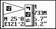
 Locosys or Scytex1) did a great job with the user interface. It has a logical and intuitive layout and is easy to use with the given controls. Speaking of controls: the NaviGPS has only two: a five way thumb knob (up - down - left - right - press) and a second simple button. The former is used to navigate the menus, the latter acts as “escape” and power button. Entering data like waypoints is done through little selection popups. Waypoints can use up to 6 characters (letters and numbers) and an icon from a quite big list.
My only gripe with the UI is the backlight function. To enable or disable the backlight you need to press the escape key. But this is also used to navigate back up from a submenu which means you can only activate the light from the top menu. A small annoyance.
The built in lithium-ion battery lasts long enough for a day's traveling. I haven't stopped the time but 8 to 10 hours seem to be realistic. If you plan to travel a country where electricity isn't too common you might want to look for a device with replaceable batteries, though. Or maybe you could connect the NaviGPS to solar panel.
 There comes no Linux software with the package but I was able to use the NaviGPS with gpsd. The USB chip is a well known and Kernel supported USB-to-Serial converter. By reverse engineering the data sent between the Windows application and the device I discovered an enhanced NMEA protocol to be used for downloading files from the internal memory. Unfortunately I wasn't able to get my own implementation to work, I'm probably missing some serial programming knowledge here.
Until someone writes a working tool, Linux users need a SD memory card and a card reader to log routes. Routes are stored in NMEA format on the card and can easily be converted to other formats with gpsbabel. Have a look at my wiki for more info about using the NaviGPS with Linux.
So what about the most important thing – the GPS performance? Because this is my first and only GPS I cannot say much about it because I can't compare. Cold starts can take quite a while (up to several minutes) warm starts are done in aproximately 30 to 45 seconds. With enough satellites and using SBAS the precision is accurate to a few meters. On cloudy days in narrow city streets your position may jump around by up to 50 meters. But I guess this is perfectly normal and I had never problems of finding a geocache due to bad accuracy.
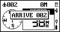
 Unfortunatly the navigation mode declares an “Arrive” in proximity of 10 meters and then stops showing the direction to the waypoint even if a more exact signal is available. This makes geocaching a little bit more challenging
If you want to buy a NaviGPS I can recommend the UK-based Storage Depot site. You can even help a good cause and let Storage Depot donate 10% of your purchase to the OpenStreetMap project – read more about it here.